Drag & Drop
The viewer supports drag & drop functionality in Mozilla Firefox or Google Chrome. Drag & Drop is not supported in current versions of Internet Explorer or Safari.
The drag & drop functionality enables other data sources to be overlaid with the data provided in the viewer.
Click the item you want to import, drag it and drop it anywhere on the map. If successful the new data will show on the map, and appear as an operational layer in the Map Contents under the "Graphics Layers" node.
The following formats are currently supported by Drag & Drop:
- ArcGIS REST endpoint URL
- KML endpoint URL
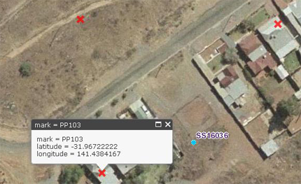
- CSV file containing Latitude and Longitude fields
- JSON file containing ESRI JSON formatted content
- Geo-tagged image files
Tip – For CSV files, there must be headers "Latitude" and "Longitude" with coordinates in decimal degrees.
Eg
| Mark | Latitude | Longitude |
|---|---|---|
| PP103 | 31.96722222 | 141.4384167 |
| PP104 | 31.96655556 | 141.4383056 |
| PP105 | 31.96657556 | 141.4393156 |


