Mark Selection
Select survey marks to suit requirements using Rectangle, Polygon, Radial or load survey marks from file.
Note: If more than 100 survey marks have been selected, a message will appear saying “Too many survey marks were returned. Please restrict the search to a smaller area".
Rectangle Search
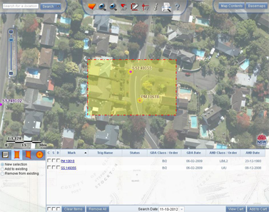
Select: "Select survey marks by rectangle" to query SCIMS by defining a rectangle or box around area of interest.
Multiple selection modes are available:
- New - denotes new search
- Add - to add survey marks selected previously
- Remove - remove survey marks selected previously
To initiate search, left click, hold and drag to surround survey marks required and release left click to finish. Search area will appear highlighted with yellow tint and a red dashed line.
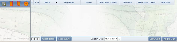
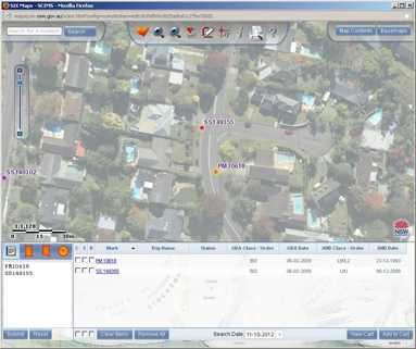
Any survey marks within the defined area will appear in the Properties summary section of the screen. Survey marks can be selected and spatial data downloaded. See Download section.
Polygon Search
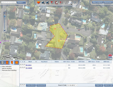
Select "Select survey marks by polygon" to query SCIMS by defining a polygon around the area of interest.
- New - denotes new search
- Add - to add survey marks selected previously
- Remove - remove survey marks selected previously
To initiate search, left click on map to start, left click for each point that will enclose the survey marks you require. Once defined area is complete, double left click. Search area will appear highlighted with yellow tint and a red dashed line.
Any survey marks within the defined area will appear in the Properties summary section of the screen. Survey marks can be selected and spatial data downloaded. See Download section.
Radial Search
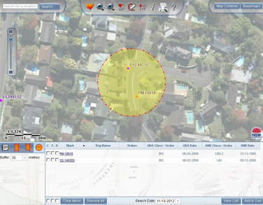
Select "Select survey marks by radius" to query SCIMS by defining a circle around area of interest.
A separate box allows the change of radius of the search to suit your requirements. The default is 350 metres with the option to select 1100 metres. Alternatively, the required radius value can be typed in.
To initiate search, left click on map to set centre of radius. Search area will be highlighted with yellow tint and a red dashed line.
Any survey marks within the defined area will appear in the Properties summary section of the screen. Survey marks can be selected and spatial data downloaded. See Download section.
Load Survey Marks from Files
To initiate search select: "Load Survey Marks from File". Survey mark type and number can be entered individually or copied from a pre-existing list and pasted into the notepad. Left click submit and results will appear in the Properties summary section of the screen. Marks do-not have to be in the same geographic location; however, if they are disparate from each other the map view will be affected. Click reset to remove text.
Survey marks can be selected and spatial data downloaded. See Download section.