File Types
Three file types are available:
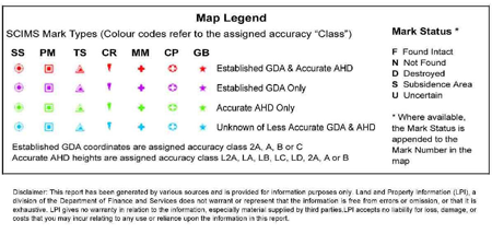
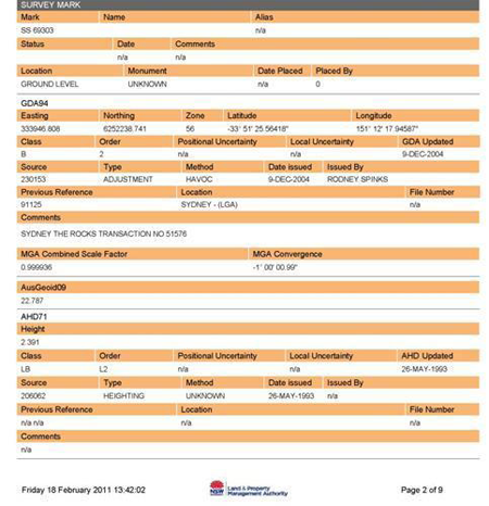
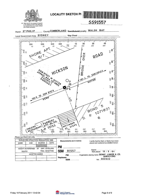
The file produced will combine elements selected as described in the Download Section and include the map screen display and map legend in one PDF file. Example shown below:

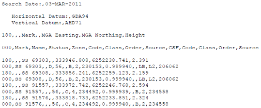
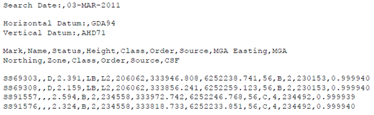
Comma Separated Variable (CSV)
Creates a standard text format file, containing spatial data only. This file is suitable for download into other applications.
MOSS
Creates a MOSS format text file containing spatial data only. This file is suitable for download into specific Roads & Maritime Services applications.